ДонНТУ > Портал магистров
RUS UKR ENG

|
Abstract Qualifying master's work "Visualisation of movement of trains with use of technologies Google map API" Introduction, urgency substantiation
System of monitoring of the railways, based on the newest technologies Google map API – the complex decision of the transport logistics, giving is unique the optimum approach to efficient control movement. Besides, creation of the given system allows the user to structure the information chosen by it according to the interests, whether it be a structure site at present or quantity of emissions by this structure. Creation of system of monitoring gives the chance to watch accurately all stream of given data, operating it voluntarily. The urgency of the given theme consists that the developed system is the first complex decision of graphic visualisation of railways. Is based on open technologies Google map and offers a set simple in use of graphic functions.
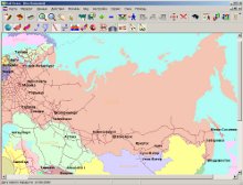
Figure 1 - Railway track The purposes and problems
The work purpose is the choice of the optimum system, allowing to automate the account of movement of trains with use of technologies Google map API for visualisation and optimisation of processes of their movement on the Donetsk railway. The problems solved in магистерской to work: 1. The system analysis of the data and an establishment of laws of movement of trains; 2. Working out of effective methods and algorithms of automation of processes; 3. Creation of the program module of interaction with card Google map; 4. Working out of the automated system of the account of movement of trains on the basis of advanced algorithms. Object of research are the graphic interface and special program modules.> Prospective scientific novelty
Scientific novelty of researches consists in: Formation of a technique of visualisation of movement of trains; To working out of the software realising this technique. To working out of a unique control system by the information; To working out of special program modules (расет environmental contaminations along the line structure, месонахождение a concrete train at present time etc.) Results robots were reported at VI international conference of students, post-graduate students and young scientists «Computer monitoring and an information technology» (КМИТ-2010) and published in the corresponding collection. The review of researches and workings out on a theme
As it is known, the ultimate goal of existence Google — to make the information accessible. In due course Google проиндексирует everything that is possible проиндексировать, and will make this data accessible to all of any point of the world (if only there there was an Internet). But the data happens different. Web-service Google Maps exists already for a long time. It is a convenient, detailed interactive card of the world, allowing to search for necessary places to addresses, postal indexes, names of streets etc. A convenient and useful site. At the same time Google Maps — something большее than simply one more (let even convenient) an electronic card. Google Maps API is a technology of company Google, allowing to place maps on sites of partners. And for such resources the full set of possibilities accessible on Google Maps, including connection of own workings out is given. In Ukraine Before recent time level of detailed elaboration of cards Google Maps in Ukraine left much to be desired: of qualitative photos of a surface big cities, and that not all could brag only. About a grid of streets and numbers of buildings, search of objects of an infrastructure could not be and speeches. However not so long ago the search giant has paid attention to our country and has considerably expanded possibilities of the cards for Ukraine. Actually, for the sake of what there are cards and cartographical services, is a portrayal of a card with addresses and sites of streets, buildings and other objects. In this direction the big work is done: if in the beginning of summer all Ukrainian cities looked a continuous grey stain now at least the regional centres and big cities can brag of a detailed address portrayal. Certainly, still not all on an Ukraine map from Google is ideal – some buildings are not numbered, not all streets are precisely named. However service can use, the quantity of errors is absolutely insignificant. Layers – point of the menu of the program which allows to add on a card the various information – labels of "Vikipedii", public transport routes, «My cards» from Google, stoppers and "Locator". As to stoppers and calculation of routes these functions while in the country do not work for us. And it is impossible to lay a route neither on a highway, nor by means of public transport, for pedestrians. To speak about high-grade functioning of all riches of services Google Maps in our country while early, however at a present stage service can already give odds to many competitors. In the world Cards Google — a set of the appendices constructed on the basis of free cartographical service and technology, given by company Google. Use of materials Google Maps is regulated by the general documents of company Google, and also a number of additional restrictions. In particular, materials are accessible to personal noncommercial use. In the organisations materials are accessible only to internal use and cannot extend in commercial objectives. There is a possibility to use service Google Maps as a basis for the foreign services. Google have created API for Google Maps on purpose to involve developers in integration Google Maps into their web sites with their geodata. It is free service, for the today, not containing advertising though also such possibility is reserved on the future in the agreement on their use. >Using Google Maps API, probably to include any card from Google Maps on an external site, operating this card through JavaScript, for example, for addition of markers of geographical points, approach or removal at viewing of cards. From recent time of card Google Maps are integrated with sites Wikipedia and Panoramio.com. Users can see Even"by means of adjustment for a card of an icon of photos available for displayed area and articles of Vikipedii. Google have created API for Google Maps on purpose to involve developers in integration Google Maps into their web sites with their geodata. Thanks to satellite pictures Google many steels to look at the world absolutely differently. By means of the given program it is possible to see any part of the world in details, and some regions are accessible from height of only several metres. In cards Google pictures from the companion
are not simply collected, but also the district topography is
considered, and some buildings are restored in three-dimensional
volume. The card contains numerous directions and designations
of the organisations, on it it is possible to mark separate objects
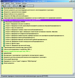
and even to draw. Workings out in the field of the account of movement of trains At the moment there are following workings out in the field of visualisation of railways: - Rail-Atlas (fig. 2)
Figure 2 - The program Rail-Atlas - RAIL-Info (fig. 3)
Figure 3 - The program Rail-Info - Esis. Current and planned results
The basic features of system of visualisation: 2) flexibility of system 3) simplicity of working out Mainframes of functions of a subsystem: 1) an objective card Function is intended for visualisation on a card of a site of the chosen spatial object (structure of a train, Ry station or settlement) and displays on it to the detailed information. Advantage of a card consists in additional tools for its as much as possible convenient use. 2) monitoring of railways and environmental contamination It is used for operative display of a situation on a finding and movement of structures on the railway. Allows to visualise the data by quantity of environmental contamination at different Ry stations and in the direction of a train. The conclusion So, the system of monitoring of movement of trains of the Donetsk railway, intended for visualisation of the data by means of technologies Google map API should become result магистерской works. Despite all technical complexities and high duration mastering by so useful and bright technology of research becomes more and more an absolute must as it essentially expands possibilities of monitoring of railways both in respect of the analysis, and in sphere of visualisation of results. The literature
1. Short review Goofle maps and Google Earth [the Electronic resource]: http://www.newestsoft.com/Windows/Home-Hobby/Other/Google-Earth.html 2. D. Yeremeev. To a city and a site: Google Maps API [the Electronic resource]: http://www.pcmag.ru/solutions/detail.php?ID=10869 3. «СТМ» Moscow. The software for railway logistics and foreign trade activities, Rail-Атлас [the Electronic resource]: http://moscow.ctm.ru/software/railway-logistic/rail-atlas 4. Gornakov S.G. Is mastered popular control systems of a site. / With. G.Gornakov. — М: ДМК the Press, 2009. 336с. 5. МСНА, MS Niteks an alliance. RAIL-Инфо - the Electronic directory for experts on Ry [the Electronic resource]: http://www.nitaks.ru/static/rinfo.html 6.Zhatkanbaeva E.A. Construction СППР in problems of safety of movement of trains [the Electronic resource]: http://www.rusnauka.com/8_NND_2010/Tecnic/59827.doc.htm 7. Mirza N.S., A.V.visualization's Starlings of the superbig surfaces — М: "Dialectics", 2007. — 624c. 8. Kolisnichenko D. N. Koridornoe mapping — М: "Dialectics", 2005. 272с. 9. Golkova L.A.monitoring of processes of movement of trains with use of technologies Google map API/L.A.Golkova//MaterialyVi of the international scientific conference of students, post-graduate students and young scientists. – Donetsk, DonNtU – 2010. 10. Forum archive. Programs of foreign trade activities from СТМ [the Electronic resource]: http://board.combat.su/UnderGround/Warez/9732.html The note At a writing of the given
author's abstract магистерская
work is not finished yet. Definitive readiness of work – December,
2010. The full text of work and materials on a theme can be received
at the author or its head after the named date.
Autobiography
|