
Summary related final work
Contents
- 1. Relevance of the work
- 2. Goals and objectives of the study
- 3. Overview of existing solutions
- 3.1 Dynamic model of the waste dump to the assessment of harmful and useful components
- 3.2 Building Models dumps using height maps, as well as specialized software
- 3.3 GIS for recording and analysis of satellite imagery heaps of coal mines
- 4. Algorithm to obtain the basic data needed to build 3D‑models of waste dump
- 4.1 Select paths
- 4.2 Alignment of the top view and side view
- 4.3 to obtain the coordinates of points
- Conclusions
- References
1. Relevance of the work
In coal regions of Ukraine one of the main sources of pollution of land and atmosphere are waste dumps, which not only reduce the area of land used is useful, but it is also dangerous hotbeds erosion, source of water pollution and soil the surrounding countryside. More than 50 % of emissions of harmful substances released burning dumps (more than 1100 rock dump, under which employs about 6300 hectares of fertile and suitable for industrial and residential construction land).
Furthermore, this environmental problem exacerbated by the global factor such as spontaneous combustion of waste dumps with the release into the atmosphere of cities and settlements of harmful gases and dust, until the explosion heaps. Spontaneous combustion is the result of a chemical process associated with a high concentration sulfur compounds. From a burning heap of medium size allocated annually about 15 tons of carbon dioxide, 5 tons of carbon monoxide and a large dust.
2. Goals and objectives of the study
There are many methods that reduce the harmful effects of waste dumps on the environment, including: surface coating dumps fertile soil and drop green space conversion, formation of landscape restoration.
To use any of the proposed methods is necessary to have information on the basic parameters of the waste dump (area, shape, slope angle, height, etc.). Such data usually has a mine to which the breed blade, but, in practice, these data are not accurate, or non-existent (such as many dumps early twentieth century).
Thus, there is a need to develop a system able to visualize the rock spoil heap and get information about its real parameters. To do this study methods of image processing waste dumps and to develop algorithms for obtaining source data necessary to build a 3D‑model of waste dump and calculation of its main parameters.
3. Overview of existing solutions
3.1 Dynamic model of the waste dump to the assessment of harmful and useful components
Article [1] proposed the concept of creating a dynamic model of the waste dump to the assessment of harmful and useful components of coal for the rational use of rocks and improve the environmental situation in the region. Through this model it is possible to analyze breed blade, the operation of which has already ended, ie show how to modify the surface of the waste dump during its operation, as well as to draft a waste dump for the formation of new mining of deposits. Construction of the model is divided into stages: getting periods forming the blade (see Figure 3.1), is analyzed mining plans, conducted underground surveying surface waste dump for a certain period of time for each period is determined by the volume and composition of the rocks.
The author argues that the developed model will solve the following problem:
1. Identify the so called risk foci
waste dump using particle size distribution of the species, which
shaped blade for a certain period of time. These homes at risk
include possible combustion sources,
and other dangerous risk factors.
2. Using placement and composition of the rocks at a certain stage Dumping on breed blade, can give advice on rational use of these rocks

Figure 3.1 – Changing the shape of the waste dump Shcheglovskaya‑Deep for a certain period of time
Disadvantage of this approach to modeling dumps is that this approach is applicable only at the stage of dumps. Although in practice for waste dumps must conduct quarterly monitoring and evaluation of basic parameters. In addition, the many old dumps, formed at the beginning of the XX century, there is no information about the periods of their formation and characteristics stockpiled rocks, which significantly narrows the scope of this approach.
3.2 Building Models dumps using height maps, as well as specialized software
Article [2] proposed the construction of models of waste dumps using height maps, as well as specialized software in particular OziExplorer (see Figure 3.2). From the results it is clear that though these products are not designed to work with waste dumps, they are good enough to cope with the task. Error building models does not exceed 10 %.
")
Figure 3.2 – 3D‑model of blade No. 2 Mospinskaya
(Mospino)
Advantages of this approach are obvious: the minimum cost, both human and material resources. Material costs are only using third‑party software. The disadvantages of this approach is the inability to calculate the main parameters of waste dumps, the receipt of which is mandatory for further classification dumps and determine the extent of the negative impact on the environment.
3.3 GIS for recording and analysis of satellite imagery heaps of coal mines
The paper [3] how to create the appropriate GIS for recording and analysis of satellite imagery heaps of coal mines.
Author proposed a method for area estimation heaps according to satellite images provided geospatial web services. The method consists in projecting geodetic coordinates of nodal points of the perimeter of the upper and lower bases of waste heaps at Cartesian coordinate system, the calculation of the base area as the area of a polygon, and subsequent measurement of the surface area on the waste heap model truncated cone (see Figure 3.3). Razrabotanaja geographic information system for recording and analysis of satellite imagery heaps of coal mine allows us to localize boundaries heaps, perform an assessment of their surface areas, as well as interactively define and predict the number of features heaps, including forecasting total annual carbon sequestration assessment of timber resources reclaimed heaps, etc.

Figure 3.3 – General view of the image in the processing using software Terrikon Explorer
4. Algorithm to obtain the basic data needed to build 3D‑models of waste dump
To build 3D‑models of waste dump requires a set of points that will be subject to form and surface triangulation waste dump.
To obtain the coordinates of points are encouraged to use photographs of the waste dump at the top and side. A photograph can be obtained from the top mapping services. Examples of such mapping services are Google Maps, Yandex maps and application Google Earth [4]. Photograph side can do yourself, using any digital camera. However, be aware that the camera should be at a sufficient distance from the waste dump, ensuring the highest possible capture of the lateral surface.
4.1 Select paths
For the base point coordinates waste dump must perform edge detection. The analysis popular methods of edge enhancement was found that not one of these methods (Roberts, Sobel, Canny, Prewitt) does not perform contouring task with the required accuracy [5]. This is due to the fact that the photographs mapping services are usually made in the summer, when the surface dumps covered with vegetation, the presence of which in the pictures has a negative impact on the accuracy of edge detection base. The paper proposes to use a semi-automatic edge detection waste dump.
To solve the problem delineation was developed for application in C#. The application allows you to select the contour of the base of the waste dump and its top position.
As graphics primitive, providing circuit isolation base stands ellipse. Initially, a draw an ellipse so to the base of the waste dump is inside the ellipse. Then, as is generally required to adjust the size and location of the ellipse. After that, you need to adjust the position of the nodes resulting figures are as accurate as possible to fit the contour of the waste dump.
Next performed positioning the top. Resulting contour and the top waste dump are independent from each other layers which greatly simplifies the creation, moving, resizing, and deleting.
Thus, the developed application allows you to select the contour of the waste dump, as well as its top position, as applicable for unimodal dumps having a conical shape (or close to it). Plan to add the capability for multiple positioning vertices for MNV dumps, as well as enhances the outline of the upper base for truncated dumps.
Exterior view of the main form of the developed application is shown in Figure 4.1.
")
Figure 4.1 – Application for semi‑automatic edge enhancement (animation consists of 5 frames with, the delay is 1 seconds between shots, the number of repetitions is 6, scope image – 116 KB)
Controls have the following functions:
- loading images into an application;
- enhances the outline base waste dump;
- positioning the top of the waste dump;
- loop partition waste dump on a plurality of nodes, allowing you to change the position of each of them;
- delete the selected layer.
Using the mouse, you can perform the following operations:
- isolation layer;
- resizing the selected layer;
- moves the selected layer.
4.2 Alignment of the top view and side view
After isolation circuit grounds waste dump and ranking tops in a plan, you must also specify the point with which the picture was taken from the side. From this point to spend two straight. Direct cross contour base waste dump in points P11 and P12. Next, you need to calculate the distance D1 between them (see Fig. 4.2).
Thus, the distance D1 – is the distance between the extremities of the base. These points are called extreme because they lie on the border of the visible and the invisible part of the lateral surface of the waste dump on the image side.

Figure 4.2 – Calculating the distance between the extreme points of the base at a top
It then computes the distance D2 in the picture side. To do this, position the point P11 and P12. Also need to calculate the height H2 to the side view. To do this, drop a perpendicular from the top to the bottom (see Fig. 4.3).

Figure 4.3 – Calculating the distance between the extreme points of the base at a side
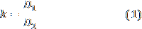
Knowing the distance D1 and D2, the coefficient is calculated k to formula:
Ratio k harmonizes snapshot waste dump side with the picture above. Thus, the ratio enables the use in the same expression data on the amount of waste dump with different shots, pre‑adjusting them.
Using factor k can calculate the height of the waste dump H1 in the picture above, converting height H2 with the picture side. This scaling operation is called and executed by the following formula:

Thus, H1 – characterizes the height of the waste dump, on the scale of the top view.
4.3 to obtain the coordinates of points
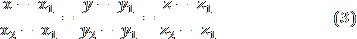
By snapshot waste dump made above, you can determine the coordinates of points of a base using a dedicated circuit namely coordinates X (width) and Z (depth). Coordinate Y is taken equal zero. By the same snapshot can also calculate the coordinates X and Z vertex coordinate Y accept equal H1.
Now held by the equation line through two points, namely, through the top, and one of the points on the bottom, you can find all the points on the line:
Varying Y in the interval (0; H1) Equation 3 can find the coordinates X and Z for all points on each of the lines. Thus, with some accuracy will be obtained coordinates of the set of points lying on the surface of the waste dump. Triangulate the obtained points can construct a 3D‑model of waste dump [6]. Note, however, that this method is applicable only for unimodal dumps with approximately conical shape.
Conclusions
A method of processing images dumps to determine the input data needed to build 3D‑models of waste dump. Developed a program in C#, provides dedicated circuit grounds waste dump and positioning its vertices.
In writing this essay master's work is not yet complete. Final completion: December 2014. Full text of the work and materials on the topic can be obtained from the author or his manager after that date.
References
- Прокопенко Е. В., Борщевский С. В. Разработка динамической модели породных отвалов угольных шахт [Электронный ресурс]. – Режим доступа: http://masters.donntu.ru.
- Паршутина А. А., Адамов В. Г. СКС расчета параметров и моделирования породных отвалов [Электронный ресурс]. – Режим доступа: http://masters.donntu.ru.
- Сурова А. Г, Адамов В. Г. [Электронный ресурс]. – Режим доступа: http://masters.donntu.ru.
- Официальный сайт Google Earth [Электронный ресурс]. – Режим доступа: http://www.google.com.ua.
- Гонсалес Р. Цифровая обработка изображений в среде MATLAB / Р. Гонсалес, Р. Вудс, С. Эддинс – М.: Техносфера, 2006. – 616 с.
- Скворцов А. В. Триангуляция Делоне и её применение. – Томск: Изд‑во Том.ун‑та, 2002. – 128 с.
- OziExplorer3D – программный модуль, позволяющий строить трехмерные модели [Электронный ресурс]. – Режим доступа: http://www.gpsvsem.ru.
- Леонов П. А., Сурначев Б. А. Породный отвал угольных шахт. – Недра, 1970.
- Яворская А. В., Артамонов В. Н. Обоснование решений возможности переработки породных отвалов [Электронный ресурс]. – Режим доступа: http://masters.donntu.ru.
- ДНАОП 1.1.30 – 5.37. – 96 Инструкция по предупреждению самовозгорания, тушению и разборке породных отвалов. Сборник инструкций к правилам безопасности в угольных шахтах. – Т.2. – Киев, 1996. – С. 358–367.