
Studies of the influence of the atmosphere on the operation of a satellite receiver
Content
- Introduction
- 1. The actuality of the topic
- 2. The purpose and objectives of the study
- Conclusion
- Sources of information
Introduction
In recent years, the efforts of a large number of researchers from different countries have been aimed at improving the accuracy of measurements carried out using global navigation satellite systems (GNSS). Such systems include, in particular, the GPS developed in the US, the Russian GLONASS and the development of the EU countries – GALILEO. Interest in the problem of the accuracy of GNSS measurements is explained by the wide application of such systems in geodesy, geophysics, navigation, environmental monitoring, metrology and basic research.
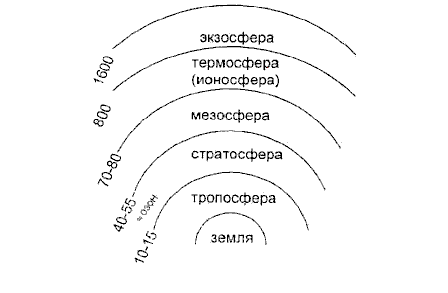
One of the main factors limiting the accuracy of GNSS measurements is the influence of the terrestrial atmosphere on the propagation characteristics of GNSS signals. The main sources of measurement error in this case are the additional signal delay in the atmosphere and the refractive curvature of the trajectory over which it propagates.
The atmosphere affects the process and results of measurements by the following factors. Attenuation of the signal (absorption of wave energy in the atmosphere) limits the range and sometimes does not allow measurements to be made at all. The change in the speed of propagation of an electromagnetic wave increases the optical (electric) length of the traversed path in comparison with its geometric length. Factors affect the measurement result, and the accuracy of these factors affects the accuracy of the final result. Modern geodetic instruments have very high accuracy, therefore the error in determining the distance (range) in the final analysis depends on the accuracy of taking into account the influence of the atmosphere. [1]
1. The actuality of the topic
The urgency of the research is determined by the rapid development of modern satellite systems. Having appeared more than four decades ago, global navigation satellite systems (GNSS) have gradually penetrated into many areas of human activity. As they evolved and there was more openness to a wide range of consumers, the tasks addressed by the GNSS went far beyond the implementation of navigation support.
The influence of the atmosphere on the measuring process reduces the accuracy of all types of geodetic measurements. The decision on the modern scientific and technical level of the problem of the method of taking into account and weakening the influence of the atmosphere remains constantly relevant and is one of the main ways to improve the accuracy of the results of geodetic observations.
2. The purpose and objectives of the study
Purpose: to assess the effect of atmospheric delays on the operation of a satellite receiver on the territory of the Donetsk region.
Tasks:
- To estimate the magnitude of the influence of the atmosphere on the operation of the satellite receiver.
- Development of recommendations for accounting for tropospheric refraction.
The idea: to test the possibility of using a satellite receiver under various meteorological conditions.
Object: errors that occur while working with a satellite receiver.
Subject: the atmosphere as a source of error.
Research method:
The following methods will be used during the work:
- Analysis of existing studies on this issue in order to learn from experience.
- Synthesis. Having studied and analyzed various works, it is necessary to synthesize the experience gained for the development of principles for taking into account the influence of the atmosphere on the territory of the Donetsk region.
Conclusion
In the course of the work, models were studied that determine the ionospheric and tropospheric delays.
According to the results of the master's work, I would like to clarify the extent to which the influence of the atmosphere on the operation of the satellite receiver on the territory of the Donetsk region can be neglected and in what cases. It is also expected to find a suitable method for taking into account the influence of the atmosphere for the territory of the Donetsk region.
Sources of information
- Серапинас Б.Б. Глобальные системы позиционирования/ Б.Б. Серапинас // Спутниковые технологии – 2002. –106 с.
- Антонович К.М. Использование спутниковых радионавигационных систем в геодезии (том2)/ К.М. Антонович // Геодезия – 2006. – 311 с.
- Классификация источников ошибок спутниковых измерений [Электронный ресурс] – Режим доступа: http://www.gps–chel.ru/gps–help/139/
- Антонович К.М. Тропосферная задержка при ГНСС измерениях // Геодезия и аэрофотосъемка. – 2012. – №1/2.
- Антонович К.М. Использование спутниковых радионавигационных систем в геодезии (том1) / К.М. Антонович//Геодезия – 2005. – 334 с.
- Антонович К.М., Фролова Е.К. Совместное использование метеоданных наземных и аэрологических наблюдений при обработке спутниковых измерений // Вестник СГГА. – 2003. – №8.
- Большая советская энциклопедия : Ионосфера[Электронный ресурс] –Режим доступа: http://www.worklib.ru/dic/Ионосфера/
- Соколов В.И. Исследование влияния качества приёма радиосигналов на точность дифференциальных GPS–измерений при коротких базах [Электронный ресурс] – Режим доступа: http://masters.donntu.ru/2007/ggeo/sokolov/diss/index.htm