
Yana Levadnyaya
Faculty of Environment and Chemical Technology
Minerals and еkological geology department
Speciality “Environmental geology”
The extent of soil contamination and water quality zones of influence of thermal power plants
Scientific adviser: Kupenko Vladimir
Resume
Summary on the exhaust work
General Characteristics work
Relationship with academic programs, plans, themes
The purpose and objectives кesearch
The idea of
object and subject of study
Possible results are expected in the performance of their novelty and significance
Contents work
SECTION II — Factors and the formation of halos of soil contamination and water pollution in relation to the thermal power station.
SECTION III — Characterization of natural and anthropogenic conditions within the boundaries of research.
SECTION IV — Comparative assessment of soil contamination zones of the thermal power stationthermal power station influence of complex exponents.
SECTION V — Assessment of the extent of water pollution zones of the thermal power station influence based on integrated indicators.
LITERATURE
General characteristics of
Relevance of research
Technogenic load industrialized areas requires constant monitoring of the state of the components of the geological environment, the main ones are the soil and aquifers. Methodological framework of control should provide reliable information on these components. On this depends the feasibility and effectiveness of environmental measures aimed at reducing the negative impacts of man-made. However, the techniques currently exist, will not reliably assess the extent of soil contamination, aquatic zones of influence of various man-made sources. The total (complex) indicators that the data used to depend on the amount involved in the calculation of the components. Therefore, improvement of techniques allowing a reliable basis to make a comprehensive assessment of the degree, nature and extent of contamination of the components of the geological environment, identify anomalies, isolate and map the halos of pollution is an important task of geological and environmental studies.
Relationship with academic programs, plans, themes
Tasks for methodological support monitoring of soil and water pollution study thermal power plants (TPP) contribute to the reliability of the monitoring of soil and water quality zones of influence. Monitoring of zones of influence TPS is now being given much attention, so that monitoring activities are part of the development programs of these companies. Need to improve the methodological basis for monitoring the environment defined by the following regulations:
- The Cabinet of Ministers of Ukraine from March 30, 1998, № 391: “Regulations about the sovereign system monіtoringu dovkіllya”;
- The Cabinet of Ministers of Ukraine dated July 20, 1996 № 815 “About the order zatverdzhennya zdіysnennya monіtoringu sovereign waters”;
- The Cabinet of Ministers of Ukraine from August 20, 1993, № 661, “Regulations about monіtoring lands.”
The purpose and objectives of research
The purpose — на базе сравнительного анализа эффективности применяемых методик по изучению и картированию ореолов загрязнения оценить достоверность и объективность результатов контроля состояния почв и водной среды на примере зон влияния тепловых электростанций.
The tasks:
- Analyze the existing methodological framework for assessing the degree of soil pollution and water pollution.
- To calculate and otkartirovat halos pollution in accordance with existing procedures.
- To calculate and otkartirovat halos pollution in accordance with the proposed methodology.
- Analyze the various estimates of the degree and nature of soil contamination and water pollution as a result of different methods.
The idea of
Based on comparative analysis of the effectiveness of isolation and mapping of halo contamination of soil and water environment in different figures to prove the most effective and reliable way to count their pollution.
Object and subject of research
The subject of the study are halos of soil contamination and water zones of influence of the thermal power plant. Areas of study include the zone of influence of smoke emissions and ash dumps of thermal power plant in Donetsk region.
Possible results are expected in the performance of their novelty and significance
For the first time a comparative analysis of the effectiveness of various indicators for the isolation and mapping of halo contamination of soils and aquatic environments. We propose to use a new geochemical index of integrated assessment of soil contamination, surface water and groundwater. Comprehensive geochemical indicator provides a unified framework to assess the degree of contamination of various media that you have set the background concentrations of elements-indicators of pollution. Integrated assessment of soil and water environment offering comprehensive geochemical indicator is statistically valid and does not depend on the amount used in calculating the elements.
The contents of the
SECTION I
The first section provides analysis of the problems of knowledge on the subject, justified the choice of the object of research. We present a technique of field work, laboratory and chemical analysis, as well as the methodological basis for assessing the extent of soil contamination and water pollution.
Development of the methodological framework for assessing the degree of environmental pollution by various man-made sources began in the 70's and 80's of last century. This was due to intensive anthropogenic impact on the geological environment of the industry, which was accompanied by the formation of geochemical anomalies in soils, aquifers, sediments.
There are different approaches to the assessment of environmental pollution. One of them is contained in "Guidelines for the Assessment of geochemical contamination of territories of cities of chemical elements" (1982). They measure the level of the anomalous element content is the concentration coefficient (Kc). As the evaluation criterion of the ecological status of soils this figure, as well as the overall pollution index (Zc) consider NG Fedorets and M. Medvedeva [5]. VA Queens in the chapter “Fundamentals of methodology for assessing technological impacts on the geological environment” of his book, “Monitoring of the geological environment” said indicators such as the coefficient of technogenic geochemical load (Ki) and the previously mentioned figure Zc [6].
In this paper, to assess the extent of environmental pollution will be applied the following methodical aspects [1–4].
As an evaluation criterion for the degree of danger of contamination of the medium is accepted indicator of pollution (IP), defined as the level of excess content of an element or compound (C) with respect to its maximum allowable concentration (MAC):
IP = C / MAC.
Use in this case it characterizes the MAC assessment of the environment as sanitary and hygienic. The degree of reliability assessment will depend entirely on the validity of the MAC.
Parameter estimates of the total polyelement pollution is the total rate of concentration of components of the aquatic environment (SEC), which is calculated as the sum of the pollution involved in the calculation of the components.
According to the recommendations of normative documents total concentration index (TCI) for water was calculated using the formula:
TCI = S1/MPC1 + S2/MPC2 + .. + Cn / MPCn, where C (1–n) — the concentration of the n-th element in the sample, MPC (1–n) — maximum permissible concentration of the n-th element in the sample.
Integrated assessment of soil quality index is used the total pollution Zc (calculated on the basis of the concentration factor for bits and pieces, the value of Kc than 1) [7].
These additive indices are easy to apply and practice can allocate complex anomalous halos, to investigate their internal structure and spatial–temporal dynamics.
However, there is a relationship of integrated pollution assessment pokazateleydlya pochvot of the analyzed elements. For example, in one case, soil concentrations of 50 elements set with Kc equal to 1.5, which corresponds to the normal fluctuations of the geochemical field, Zc will then be equal to 24 and correspond to a moderately dangerous degree of pollution. In another case, in excess of one sample set of cadmium of 24 geophones, which background at 1 mg / kg will be responsible 6.0 MAC. On the total index of pollution, both samples are assessed with the same degree of danger, and in relation to the MPC in the first sample contamination is absent, and the second is classified as dangerous, since cadmium element of the first class of danger. This example illustrates the weakness of the total additive indices.
The proposed methodology is based on a study of geochemical parameters of the field, variability in the concentrations of elements under the influence of various factors, natural or man–made [8].
Under the geochemical field of space is to be understood within a specific geological environment, which establishes a regular distribution of all chemical elements. The main parameters of geochemical fields are concentrations of the elements, the shape of their location and nature of the distribution. There is a pattern: the higher sredneesoderzhanie element in the study environment, the uniform (stable) nature of its distribution in the geochemical field.
Normal (background) field describes the geochemical relatively stable equilibrium within the study of genetically homogeneous medium in the space where the processes that lead to a significant redistribution of the elements that are not manifested or expressed only slightly. Genetically homogeneous medium is formed into a single, unidirectional petrogenetic or physical–chemical processes occurring in a certain period of time.
Genetically homogeneous medium characterized by sustained normal geochemical field, which is represented by a specific range of elements. There is a set of indicator elements, which is typical of the distribution is not in general, but only for a particular component of the medium. Therefore, background concentrations of elements of the various components of the media are different.
In a perfectly normal (abstract) geochemical field uniform over the real structural parameters of the medium concentration ratios of all elements in all its parts are close to unity. Any imposition of secondary natural or man-made processes, accompanied by a redistribution, or removal by additional elements, leads to changes in the geochemical parameters of the primary field. These changes are recorded as anomalies, which occupy certain areas within the study area of the geochemical field. In those areas noted the logical inconsistency of the primary geochemical field, the degree of manifestation of which depends on the intensity of redistribution, mainly introduces an element. These anomalies are superimposed a secondary nature and are associated with certain sources and processes.
Accordingly, the task of detecting anomalous halos is reduced to the determination of areas with impaired primary geochemical field. The proposed methodology allows it to realize it by examining the dispersion of the distribution of elements, which in this case a measure of dispersion coefficients of the element concentrations around their mean values within one sample. To do this, perform the following calculations:
- calculate the concentration ratios of elements (as the ratio of the concentration of elements in his background);
- determine the degree of disturbance of the primary geochemical field, calculating the statistical variance of the distribution coefficient of element concentrations for each sample [8].
In the background geochemical field, where the concentration ratios of all the elements tend to unity, the variance of their distribution will be close to zero, which characterizes the absence of disturbance of the field. Kc deviation of even one element of the average within the sample, especially upwards, leading to commensurate increase in the dispersion. The higher growth Kc one or more elements, the higher the variance of the distribution and degree of disturbance, respectively, of the geochemical field. Therefore, the estimated statistical variance in this case is a complex indicator of abnormality (CIA). Using the CIA, the calculations can be carried out over a large range of elements for all types of environments for which the calculated background concentrations.
CIA is calculated for the macro-and micronutrients separately. This is due to their different roles, the nature of the distribution, level of concentration and form of the finding in the geological processes and formations. CIA are useful in environmental studies, for example, for risk assessment of soils as a comprehensive measure of pollution.
SECTION II
The second section is devoted to natural and man-made factors and the formation of halos of soil contamination and water pollution in connection with the activities of TPP.
Halos pollution from the source are regular zonal structure and are shaped by natural and anthropogenic factors. Consider the factors and processes of the formation of halos of pollution as an example Zuevskaya TPP.
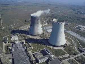
Picture 1 —Photographs Zuevskaya TPP
Among the major environmental factors can be identified climate and landscape–geochemical. The climate of the study area is continental, characterized by hot dry summers and moderately cold winters with precipitation. In the autumn for the area is characterized by high humidity and fog, which contribute to the deposition of pollutants emissions on a smaller distance from the source and more concentrated. Winds prevail dry, which in winter are accompanied by frosts, snowstorms, and in summer often drought and dust storms. In dry periods with high temperatures and low relative humidity winds occur, which cause rapid development of wind erosion. Wind increases the process of pollination, when the ash dump in the bowl formed dry zoloshlakov beaches. Therefore, wind is a factor in the migration of suspended particles of various flue gas emissions and affects the differentiation of elements and their compounds. The quantity, quality and chemical composition of precipitation are direct factors directly influencing the hydrological, hydrodynamic and hydrochemical conditions territoriy.Nemalovazhnoe important temperature regime. In cold weather, often marked increase in the level of contamination at low temperatures, and as a consequence of increasing the number of harmful emissions into the atmosphere and their deposition on the surface of the earth.
Topography determines the direction of surface runoff and subsurface flow, allows us to establish the boundaries of zones of influence of pollution sources. In general, the relief area is characterized by a large rugged, steep slopes. The slope of the surface is oriented to the south and south-east of the thalweg &madsh; used. Bol. Skelevataya. Drained of its water with the runoff on the network of streams drain into the p. Jug, providing thus a direct impact on the hydrological and hydrochemical regimes of the watershed area reki.V spaces forms of relief flowing, as it approaches the river valleys and gullies slopes increase, the processes occur gully and plane flush.
In the area of the ash dump Zuevskaya TPP are three types of geochemical landscapes: biogenic, abiogenic and man–made. Relief, as well as wind erosion affects the distribution of heavy metals in soils. In the eluvial landscapes may be a blow out the lighter particles of soil and accumulation of heavy metals with higher atomic mass in the upper soil horizon. Erosional processes characteristic landscape of watersheds, which are caused not only by natural conditions, but unsustainable economic activity. Plantation landscapes that are distributed along agricultural land, are a kind of barrier to the spread of contaminants dispersing in the air. In general, these landscapes have an impact on the state of soils, condition and location of migration of contaminants.
The main element of the hydrographic network deployment area Zuevskaya TPP is Krynka river. Within the study area the river has a general flow direction from north to south. On the basis of p. Jug for industrial and domestic needs created Volyntsevskoe, Hanzhenkovskoe Zuevskaya and reservoirs. On the basis of its right tributary. Olkhovka created Olkhovsky reservoir.
Within the area of thermal power stations are allocated aquifers and Quaternary aquifer system is fractured zones of bedrock carbon. Water–bearing rocks are fractured zone of sandstone and mudstone. In zones of intense fracturing aquifers merge and form a single aquifer system, often with a free surface. Food bearing complexes is due to infiltration of rainfall and overflow of water from overlying aquifers.
Underground aquifers are vulnerable to the impact of the ash dump. Water pollution is associated with infiltration of technogenic water of the ash dump and atmospheric water containing washed from the soil layer and toxic contaminants. The spatial structure of the halo formation of pollution is mainly due to the direction of movement of groundwater, physical, mechanical and physico-chemical properties of water-bearing rocks and tectonic structure of the site. Pockets of contamination is usually confined to areas of sandstone distribution. These rocks, having a large fractures and high filtration properties, promote freer migration of polluting elements from the cup of the ash dump into the groundwater. Mudstones have waterproof properties. Together with well-developed in the clay minerals that make up the mudstone, sorption properties, these rocks provide the deposition of polluting substances at the free surface of clay minerals, as well as virtually eliminate seepage infiltrates into the groundwater.
Water pollution in the zone of influence Zuevskaya TPP occurs directly by the infiltration of underground water sources and discharges into water bodies [10]. Soil pollution while going through the dust load and the impact of waste thermal power plants.
Man–made factors affecting the formation of halos of soil contamination and water pollution, emissions associated with thermal power plants flue gases; landfill (ash dump), industrial activity units thermal power plants (fuel oil industry, coal storage, zoloshlakoprovody) discharges of heated water in the reservoir. According to the classification of sources of air pollution thermal power plant is continuously active source with time-varying nature of the hot high-altitude emissions.
Direct impact on the environment in the area of thermal power plants have a waste hazard class 4: zoloshlaki, the sludge water. Wastewater and stormwater runoff from areas TPP-contaminated waste process cycle power plants, and containing vanadium, nickel, fluoride, phenolics, and petroleum products at dumping into the water affect the water quality. In the waters of the ash dump is often higher than normal salinity, barium, vanadium, iron, cobalt, nickel, copper, zinc, lead and cadmium. Influence on the composition of the ash dump groundwater is expressed in high concentrations of heavy metals, Mn, Al, Co, Ni, Bi, Be. In the direction of the ash dump to the river Krynka fixed regular changes in water chemistry. The chemical composition of water varies due to the infiltration into the soil of industrial wastewater containing contaminants.
The main elements of polluting soil – cobalt, copper, molybdenum, lead, cadmium, selenium, strontium. On soil pollution, the area around Zuevskaya TPP affects a number of sources of impact: agricultural and industrial activities, human settlements, roads and railways. Thus, the interaction of these factors determines the conditions of migration and localization of harmful substances in soil and water environment, ie the conditions of formation of anomalous halos pollution.
SECTION III
For a full and objective evaluation of the impact of the objects necessary element is the characteristic conditions of the territory described in the third section of the master's work. Among the natural environment allocated areas of research: the relief, geomorphological and climatic conditions, geological structure and hydrogeological conditions. Not less important is the characterization of man-made environment, economic activities and technological processes, the presence of additional sources of pollution affecting the state of the environment, as well as the nature, scale and intensity of the impact of human activities within the territory of the object.
SECTION IV
The fourth section provides a comparative assessment of the extent of soil contamination zones of influence of TPP complex exponents. The calculation of geochemical indicators has been undertaken in accordance with a previously described method, according to the results of chemical analysis of soils. Consider the figures obtained by the example of one of the objects of study, the ash dump Zuevskaya TPP.
Effects on soil and ground vegetation is limited to the nearest periphery of the ash disposal area (300 m). Contamination occurs during dry dusting beaches zoloshlakov ash dump in the bowl. Risk assessment of contamination of soils has been calculated the total pollution index (Zs) and the statistical variance of the distribution coefficient of element concentrations for each sample (tabl. 1)
Table 1—calculation of the total score of pollution and the statistical dispersion of the distribution coefficient of element concentrations
| № пр. | Кс | Zc | DISP | |||||||||||||||
| Pb | Cd | Se | Hg | Mo | Zn | Cu | Ni | Co | Fe | Mn | Cr | V | Bi | Ti | Ba | |||
| Сф | 20 | 0,5 | 0,5 | 0,028 | 1,230 | 95 | 30 | 44,3 | 18 | 27900 | 700 | 96,1 | 65 | 1,8 | 4880 | 366 | ||
| 1 | 2,40 | 0,80 | 0,80 | 96,43 | 16,02 | 1,00 | 2,21 | 2,82 | 2,85 | 0,00010 | 0,33 | 0,24 | 0,12 | 1,61 | 0,02 | 1,33 | 126,3 | 569,92 |
| 2 | 1,20 | 4,00 | 1,20 | 32,14 | 2,28 | 0,88 | 1,77 | 2,66 | 2,87 | 0,00006 | 0,48 | 0,37 | 0,00 | 4,06 | 0,07 | 1,07 | 42,1 | 60,34 |
| 3 | 2,07 | 3,40 | 1,00 | 35,71 | 0,00 | 1,35 | 1,58 | 1,25 | 2,69 | 0,00011 | 0,40 | 0,01 | 0,22 | 0,00 | 0,01 | 0,38 | 54,42 | 76,61 |
| 4 | 1,71 | 0,00 | 0,00 | 71,43 | 0,00 | 1,20 | 0,08 | 2,08 | 2,38 | 0,00007 | 0,57 | 0,10 | 0,00 | 0,00 | 0,04 | 0,00 | 75,03 | 314,73 |
| 5 | 4,32 | 4,60 | 1,20 | 0,00 | 4,63 | 1,98 | 1,98 | 0,48 | 3,23 | 0,00008 | 0,27 | 0,12 | 0,00 | 17,67 | 0,04 | 1,06 | 30,57 | 19,10 |
| 6 | 0,40 | 0,00 | 0,00 | 0,00 | 32,44 | 0,40 | 1,54 | 2,18 | 2,39 | 0,00009 | 0,49 | 0,23 | 0,44 | 0,00 | 0,05 | 0,85 | 64,34 | 63,97 |
| 7 | 1,15 | 0,00 | 0,00 | 114,29 | 1,30 | 0,31 | 1,51 | 0,00 | 3,22 | 0,00006 | 0,46 | 0,39 | 0,45 | 32,33 | 0,00 | 0,96 | 178,42 | 839,72 |
| 8 | 0,00 | 0,00 | 0,20 | 110,71 | 0,00 | 0,87 | 0,00 | 0,74 | 1,16 | 0,00006 | 0,56 | 0,06 | 0,08 | 4,56 | 0,00 | 0,18 | 118,99 | 759,64 |
| 9 | 0,00 | 4,00 | 0,80 | 103,57 | 7,80 | 0,98 | 2,40 | 1,51 | 0,00 | 0,00006 | 0,49 | 0,20 | 0,20 | 12,78 | 0,04 | 0,00 | 137,99 | 656,12 |
| 10 | 0,62 | 6,00 | 0,80 | 121,43 | 0,00 | 0,64 | 2,18 | 0,00 | 2,93 | 0,00007 | 0,27 | 0,00 | 0,00 | 0,00 | 0,01 | 1,16 | 126,69 | 909,37 |
| 11 | 0,75 | 0,00 | 0,60 | 67,86 | 1,95 | 0,97 | 0,11 | 0,90 | 2,62 | 0,00006 | 0,25 | 0,09 | 0,03 | 0,00 | 0,03 | 0,93 | 71,67 | 283,17 |
| 12 | 1,01 | 0,00 | 0,60 | 10,71 | 6,99 | 1,46 | 2,50 | 0,99 | 2,16 | 0,00009 | 0,26 | 0,20 | 0,43 | 0,00 | 0,00 | 0,27 | 64,28 | 8,79 |
| 13 | 0,35 | 3,80 | 0,00 | 0,00 | 0,00 | 0,96 | 0,90 | 1,91 | 0,49 | 0,00004 | 0,00 | 0,02 | 0,00 | 0,00 | 0,01 | 1,18 | 3,14 | 1,05 |
| 14 | 1,75 | 3,60 | 0,00 | 67,86 | 1,38 | 0,91 | 0,00 | 1,28 | 0,00 | 0,00003 | 0,20 | 0,05 | 0,19 | 0,00 | 0,04 | 0,93 | 82,28 | 282,92 |
| 15 | 3,29 | 0,00 | 0,40 | 0,00 | 6,42 | 0,28 | 0,00 | 0,00 | 2,21 | 0,00003 | 0,28 | 0,11 | 0,10 | 0,00 | 0,01 | 0,67 | 15,9 | 3,06 |
| 16 | 2,20 | 0,00 | 0,00 | 0,00 | 0,00 | 0,62 | 2,30 | 2,39 | 2,90 | 0,00011 | 0,00 | 0,16 | 0,10 | 11,78 | 0,03 | 0,42 | 23,02 | 8,72 |
| 17 | 1,57 | 3,20 | 0,60 | 64,29 | 14,63 | 0,90 | 2,08 | 0,58 | 2,25 | 0,00009 | 0,30 | 0,19 | 0,09 | 12,94 | 0,07 | 1,22 | 98,5 | 256,78 |
In most of the notes is a dangerous degree of pollution (32–128 Zc), which is controlled by a cup of ash dump, its contours, extending to the south, south-west. The site is extremely dangerous levels of pollution (Zc> 128) stands 200 meters from the ash dump and is controlled by № 7 and № 9. Halo of the total contamination of soils in the north of the contour ash dump section number 16 and west of the ash dump part number 5 with a moderately dangerous level of pollution in the east part number 15 and the south part № 13 permissible level of contamination.
The maximum value of dispersion of the distribution coefficient of element concentrations are also characteristic for the main part of the study area and ranged 256,78-909,37. Halos, charted on the indicator, generally similar to those of halos, selected by Zc, but more accurately reflect their spatial confinement.
SECTION V
The fifth section presents an assessment of the degree of water pollution zones of influence of coal-based synthetic indicators. The main impact of ash dump Zuevskaya TPS has it on the surface and underground water. This is because debalansovaya, clarified water with high salinity, hardness, high concentrations of sulfates, chlorides, sodium, and some other components of the stream is reset b. Skelevatoy in p. Jug. Groundwater is experiencing a local impact in the infiltration of water into the ash aquifers.
Studying the impact of the ash dump Zuevskaya TPP in the aquatic environment was based on the results of chemical analysis of samples of surface and groundwater, have been calculated total concentrations (CPK) on organoleptic and sanitary-toxicological criteria (tabl. 2)
Table 2—the calculation of total concentration index (TCI)
| № п. | Br | V | Cr(3) | Co | Ni | Hq | Pb | Bi | Se | Cd | NO3- | NH4+ | Аl | СПК | SO4 | Cl | Mn | Fe | Cu | Zn | СПК |
| 0,2 | 0,1 | 0,5 | 0,1 | 0,1 | 0,0005 | 0,03 | 0,1 | 0,01 | 0,001 | 50 | 2 | 0,5 | 500 | 350 | 0,1 | 0,3 | 1 | 1 | |||
| П-39 | 0,80 | 0,00 | 0,12 | 0,20 | 0,60 | 0,00 | 1,20 | 0,00 | 0,40 | 0,40 | 0,35 | 0,41 | 0,24 | 4,72 | 1,89 | 1,47 | 1,00 | 1,47 | 0,32 | 0,26 | 6,41 |
| П-40 | 0,80 | 0,20 | 0,14 | 0,20 | 0,50 | 0,00 | 9,33 | 0,00 | 0,00 | 0,00 | 0,35 | 0,49 | 0,42 | 12,43 | 2,37 | 0,99 | 1,00 | 1,17 | 0,37 | 0,28 | 6,18 |
| П-42 | 0,70 | 0,00 | 0,14 | 0,40 | 0,60 | 0,00 | 12,00 | 0,00 | 0,00 | 0,00 | 0,46 | 0,42 | 0,68 | 15,40 | 2,45 | 1,61 | 1,33 | 1,20 | 0,31 | 0,32 | 7,22 |
| П-42а | 0,45 | 0,00 | 0,24 | 0,00 | 0,20 | 0,00 | 0,67 | 0,00 | 0,40 | 0,00 | 0,23 | 0,42 | 0,48 | 3,08 | 2,27 | 1,44 | 0,93 | 2,27 | 0,36 | 0,36 | 7,63 |
| П-44 | 0,60 | 0,50 | 0,20 | 0,00 | 0,60 | 0,00 | 0,40 | 0,00 | 0,00 | 0,00 | 0,25 | 0,73 | 0,24 | 3,52 | 2,33 | 1,13 | 0,93 | 0,60 | 0,18 | 0,34 | 5,52 |
| П-45 | 1,25 | 0,80 | 0,36 | 0,60 | 0,80 | 0,00 | 0,50 | 0,30 | 0,00 | 0,00 | 0,52 | 0,49 | 0,16 | 5,77 | 2,89 | 1,12 | 1,60 | 1,27 | 0,24 | 0,44 | 7,56 |
| П-49а | 0,90 | 0,80 | 0,30 | 0,50 | 0,80 | 0,00 | 0,67 | 0,60 | 0,40 | 0,40 | 0,52 | 0,82 | 0,68 | 7,38 | 2,80 | 1,12 | 1,33 | 1,20 | 0,32 | 0,32 | 7,10 |
| П-47 | 0,55 | 0,00 | 0,00 | 0,00 | 0,00 | 0,00 | 0,30 | 0,00 | 0,00 | 0,00 | 0,30 | 0,76 | 0,36 | 2,26 | 2,10 | 1,14 | 0,53 | 1,00 | 0,00 | 0,30 | 5,07 |
| П-53 | 0,00 | 0,00 | 0,00 | 0,00 | 0,20 | 0,00 | 0,30 | 0,00 | 0,00 | 0,00 | 0,07 | 0,00 | 0,40 | 0,97 | 0,39 | 2,68 | 0,33 | 1,00 | 0,43 | 0,30 | 5,13 |
| П-55 | 0,00 | 0,00 | 0,04 | 0,00 | 0,20 | 0,00 | 0,33 | 0,00 | 0,00 | 0,80 | 0,30 | 0,43 | 0,40 | 2,51 | 2,42 | 0,87 | 0,53 | 0,93 | 0,12 | 0,32 | 5,20 |
| П-56 | 0,00 | 0,00 | 0,00 | 0,00 | 0,20 | 0,00 | 0,00 | 0,00 | 0,00 | 0,00 | 0,03 | 0,00 | 0,00 | 0,23 | 1,44 | 0,96 | 0,27 | 1,73 | 0,09 | 0,38 | 4,87 |
| 107а | 0,40 | 0,00 | 0,06 | 0,00 | 0,50 | 0,00 | 0,00 | 0,00 | 0,00 | 0,00 | 0,12 | 0,45 | 0,00 | 1,53 | 1,85 | 0,94 | 0,27 | 0,57 | 0,12 | 0,42 | 4,17 |
| Р. | 0,00 | 0,00 | 0,04 | 0,00 | 0,60 | 0,00 | 0,00 | 0,00 | 0,00 | 0,00 | 0,00 | 0,00 | 0,14 | 0,78 | 0,61 | 0,44 | 0,27 | 0,57 | 0,08 | 0,12 | 2,08 |
| П-15 | 0,40 | 0,40 | 0,08 | 0,00 | 0,80 | 0,00 | 0,40 | 0,30 | 0,40 | 0,00 | 0,46 | 0,47 | 0,40 | 4,11 | 2,13 | 1,37 | 0,00 | 0,67 | 0,24 | 0,38 | 4,78 |
| П-10 | 0,60 | 0,00 | 0,08 | 0,00 | 0,60 | 0,00 | 0,33 | 0,00 | 0,50 | 1,60 | 0,00 | 0,45 | 0,24 | 4,40 | 2,01 | 1,30 | 0,33 | 0,80 | 0,20 | 0,36 | 5,01 |
| П-15а | 0,90 | 0,80 | 0,24 | 0,60 | 0,50 | 1,20 | 1,40 | 0,80 | 0,40 | 0,00 | 0,25 | 0,81 | 0,72 | 8,62 | 2,89 | 1,23 | 1,07 | 1,23 | 0,28 | 0,42 | 7,12 |
| П-20 | 1,20 | 0,80 | 0,36 | 0,60 | 0,80 | 1,40 | 1,53 | 0,80 | 0,60 | 1,60 | 0,47 | 1,09 | 0,48 | 11,73 | 2,58 | 1,35 | 1,33 | 1,07 | 0,42 | 0,42 | 7,17 |
| П-20а | 0,00 | 0,00 | 0,00 | 0,00 | 0,40 | 0,00 | 0,00 | 0,00 | 0,00 | 0,00 | 0,00 | 0,00 | 0,00 | 0,40 | 0,23 | 0,18 | 0,00 | 0,47 | 0,08 | 0,17 | 1,12 |
| П-27 | 0,90 | 0,50 | 0,12 | 0,20 | 0,40 | 0,00 | 0,83 | 0,00 | 0,00 | 0,00 | 0,21 | 0,45 | 0,40 | 4,01 | 2,29 | 1,06 | 1,13 | 1,20 | 0,34 | 0,39 | 6,41 |
| П-21 | 1,00 | 0,80 | 0,24 | 0,60 | 0,80 | 1,00 | 1,53 | 0,70 | 0,00 | 2,00 | 0,51 | 1,07 | 0,76 | 11,01 | 3,72 | 1,59 | 1,33 | 2,13 | 0,36 | 0,42 | 9,55 |
| Пр1 | 0,90 | 0,60 | 0,22 | 0,20 | 0,80 | 1,60 | 1,07 | 0,00 | 0,00 | 0,00 | 0,45 | 0,32 | 0,62 | 6,77 | 2,27 | 1,16 | 1,33 | 1,73 | 0,21 | 0,42 | 7,13 |
| Пр2 | 0,80 | 0,40 | 0,16 | 0,40 | 0,60 | 1,20 | 0,93 | 0,20 | 0,00 | 0,00 | 0,31 | 0,56 | 0,48 | 6,04 | 2,21 | 1,06 | 1,60 | 1,40 | 0,23 | 0,47 | 6,97 |
| Пр3 | 0,70 | 0,00 | 0,16 | 0,40 | 0,80 | 1,20 | 1,07 | 0,00 | 0,60 | 0,00 | 0,17 | 0,53 | 0,16 | 5,79 | 2,58 | 0,98 | 1,20 | 1,83 | 0,37 | 0,44 | 7,41 |
The highest groundwater contamination found in the group of indicators included in the organoleptic characteristic. The total contamination of groundwater on the basis of almost all sampling sites exceeding the permissible level. The main pollutants are sulfate, the maximum degree of concentration which is observed in the P–21 (3.72 MAC). The degree of pollution also affect chloride, manganese and iron, which figures in most of the samples exceed the maximum allowable. Halo of total pollution is local appearance and spatially and genetically related to the ash dumps. Most of the territory a high degree of contamination (from 4 to 8 TIP). The epicenter of the high degree of contamination is controlled by a cup of ash disposal area extends under the direction of groundwater movement to the west and southwest. In this case the shape of the halo contamination influence of geological and structural features of the site (fracture zone enhances the halo to the south-west of the ash dump). Point anomaly extremely high degree of pollution in paragraph 21, is due to the predominance of sandstone here.
The main pollutants in sanitary–toxicological grounds are mercury (Hg), lead (Pb), cadmium (Cd) and bromine (Br), which are in the process of filtering polluted water precipitated on geochemical barriers, communicating the substance of the country rocks. The level of pollution varies from acceptable (less than 1 SEC) to extremely high (more than 10 SEC). Halos pollution components of sanitary–toxicological characteristic is also controlled by ash dumps.
According to the proposed method were calculated concentration ratios relative to the background (KS) and determined the statistical variance of the distribution coefficient of element concentrations in each sample separately for trace elements and macro–(tabl. 3, 4)
Table 3—the calculation of the statistical variance of the distribution of macro-
| № п. | Кс | DISP | ||||||
| CO3 (2-) | HCO3(-) | SO4 | Cl | Ca | Mg | Na+K | ||
| Сф | 3,522 | 160,91 | 144,53 | 117,85 | 68,08 | 51,16 | 65,75 | |
| П-39 | 0,43 | 0,93 | 6,54 | 4,37 | 1,00 | 0,66 | 8,73 | 11,21 |
| П-40 | 7,52 | 0,33 | 8,20 | 2,95 | 0,88 | 0,12 | 9,83 | 17,14 |
| П-42 | 3,35 | 0,41 | 8,46 | 4,78 | 1,01 | 0,47 | 11,22 | 17,82 |
| П-42а | 0,30 | 7,84 | 4,28 | 1,18 | 0,81 | 8,57 | 13,50 | |
| П-44 | 3,35 | 0,59 | 8,07 | 3,37 | 1,03 | 0,07 | 9,79 | 14,39 |
| П-45 | 10,85 | 0,41 | 9,99 | 3,34 | 1,64 | 9,90 | 22,40 | |
| П-49а | 7,52 | 0,45 | 9,70 | 3,34 | 1,45 | 0,02 | 10,11 | 19,10 |
| П-47 | 1,45 | 7,26 | 3,39 | 0,82 | 1,07 | 8,86 | 11,92 | |
| П-53 | 2,45 | 1,33 | 7,97 | 1,16 | 0,19 | 8,97 | 14,38 | |
| П-55 | 1,11 | 8,36 | 2,60 | 1,08 | 1,26 | 7,57 | 11,50 | |
| П-56 | 0,78 | 4,98 | 2,86 | 0,71 | 1,00 | 5,61 | 4,85 | |
| 107а | 3,35 | 0,30 | 6,41 | 2,80 | 0,75 | 0,17 | 7,90 | 9,35 |
| Р. | 1,30 | 2,12 | 1,30 | 0,84 | 0,57 | 1,22 | 0,28 | |
| П-15 | 0,74 | 7,36 | 4,07 | 0,95 | 0,40 | 9,65 | 15,17 | |
| П-10 | 0,74 | 6,97 | 3,87 | 1,01 | 0,31 | 8,90 | 13,03 | |
| П-15а | 0,43 | 1,00 | 9,99 | 3,66 | 1,85 | 1,35 | 7,59 | 13,61 |
| П-20 | 2,01 | 8,92 | 4,01 | 1,61 | 0,10 | 10,57 | 18,13 | |
| П-20а | 0,67 | 0,78 | 0,53 | 0,36 | 0,40 | 0,21 | 0,04 | |
| П-27 | 1,15 | 7,91 | 3,16 | 1,27 | 0,59 | 8,07 | 11,83 | |
| П-21 | 1,86 | 12,86 | 4,72 | 2,30 | 0,97 | 11,75 | 27,49 | |
| Пр1 | 20,87 | 1,78 | 7,84 | 3,45 | 0,80 | 1,26 | 10,57 | 52,69 |
| Пр2 | 18,37 | 1,97 | 7,65 | 3,16 | 0,96 | 0,88 | 10,07 | 41,35 |
| Пр3 | 0,97 | 8,92 | 2,92 | 1,28 | 0,81 | 8,36 | 14,21 | |
Table 4—the calculation of the statistical dispersion of the distribution of trace elements
| Кc | DISP | |||||||||||||||||
| № п. | Br | Ti | V | Cr(3) | Mn | Fe | Co | Ni | Cu | Zn | Mo | Hq | Pb | Bi | Se | Cd | Sr | |
| Сф | 0,0087 | 0,038 | 0,0058 | 0,029 | 0,036 | 0,202 | 0,011 | 0,07 | 0,23 | 0,193 | 0,011 | 0,000057 | 0,0045 | 0,0021 | 0,0043 | 0,0004 | 0,151 | |
| П-39 | 18,39 | 1,05 | 0,00 | 2,07 | 4,17 | 2,18 | 1,82 | 0,86 | 1,39 | 1,35 | 4,55 | 8,00 | 0,93 | 1,00 | 2,45 | 0,01 | ||
| П-40 | 18,39 | 1,05 | 3,45 | 2,41 | 4,17 | 1,73 | 1,82 | 0,71 | 1,61 | 1,45 | 4,55 | 62,22 | 2,78 | 21,29 | ||||
| П-42 | 16,09 | 1,58 | 2,41 | 5,56 | 1,78 | 3,64 | 0,86 | 1,35 | 1,66 | 80,00 | 2,78 | 284,66 | ||||||
| П-42а | 10,34 | 0,53 | 4,14 | 3,89 | 3,37 | 0,29 | 1,57 | 1,87 | 4,44 | 0,93 | 2,52 | 546,81 | ||||||
| П-44 | 13,79 | 8,62 | 3,45 | 3,89 | 0,89 | 0,86 | 0,78 | 1,76 | 2,67 | 0,60 | 7,95 | |||||||
| П-45 | 28,74 | 2,11 | 13,79 | 6,21 | 6,67 | 1,88 | 5,45 | 1,14 | 1,04 | 2,28 | 7,27 | 3,33 | 14,29 | 0,00 | 18,35 | |||
| П-49а | 20,69 | 1,58 | 13,79 | 5,17 | 5,56 | 1,78 | 4,55 | 1,14 | 1,39 | 1,66 | 4,44 | 28,57 | 0,93 | 1,00 | 2,52 | 59,89 | ||
| П-47 | 12,64 | 1,05 | 2,22 | 1,49 | 1,55 | 2,00 | 68,12 | |||||||||||
| П-53 | 1,39 | 1,49 | 0,29 | 1,87 | 1,55 | 2,00 | 20,26 | |||||||||||
| П-55 | 0,69 | 2,22 | 1,39 | 0,29 | 0,52 | 1,66 | 2,22 | 2,00 | 2,45 | 0,37 | ||||||||
| П-56 | 1,11 | 2,57 | 0,29 | 0,39 | 1,97 | 0,00 | 1,85 | 0,67 | ||||||||||
| 107а | 9,20 | 0,53 | 1,03 | 1,11 | 0,84 | 0,71 | 0,52 | 2,18 | 0,00 | 0,97 | ||||||||
| Р. | 0,69 | 1,11 | 0,84 | 0,86 | 0,35 | 0,62 | 0,00 | 1,85 | 8,06 | |||||||||
| П-15 | 9,20 | 1,05 | 6,90 | 1,38 | 0,99 | 1,14 | 1,04 | 1,97 | 2,67 | 14,29 | 0,93 | 0,30 | ||||||
| П-10 | 13,79 | 1,05 | 0,00 | 1,38 | 1,39 | 1,19 | 0,86 | 0,87 | 1,87 | 2,22 | 1,16 | 4,00 | 4,04 | 19,75 | ||||
| П-15а | 20,69 | 2,11 | 13,79 | 4,14 | 4,44 | 1,83 | 5,45 | 0,71 | 1,22 | 2,18 | 7,27 | 10,53 | 9,33 | 38,10 | 0,93 | 4,24 | 12,68 | |
| П-20 | 27,59 | 1,32 | 13,79 | 6,21 | 5,56 | 1,58 | 5,45 | 1,14 | 1,83 | 2,18 | 12,28 | 10,22 | 38,10 | 1,40 | 4,00 | 4,24 | 94,19 | |
| П-20а | 0,69 | 0,57 | 0,35 | 0,88 | 109,04 | |||||||||||||
| П-27 | 20,69 | 2,11 | 8,62 | 2,07 | 4,72 | 1,78 | 1,82 | 0,57 | 1,48 | 2,02 | 9,09 | 5,56 | 3,44 | 0,05 | ||||
| П-21 | 22,99 | 2,63 | 13,79 | 4,14 | 5,56 | 3,17 | 5,45 | 1,14 | 1,57 | 2,18 | 10,91 | 8,77 | 10,22 | 33,33 | 5,70 | 29,76 | ||
| Пр1 | 20,69 | 2,11 | 10,34 | 3,79 | 5,56 | 2,57 | 1,82 | 1,14 | 0,91 | 2,18 | 7,27 | 14,04 | 7,11 | 0,00 | 5,56 | 79,45 | ||
| Пр2 | 18,39 | 1,05 | 6,90 | 2,76 | 6,67 | 2,08 | 3,64 | 0,86 | 1,00 | 2,44 | 5,45 | 10,53 | 6,22 | 9,52 | 3,77 | 32,16 | ||
| Пр3 | 16,09 | 2,76 | 5,00 | 2,72 | 3,64 | 1,14 | 1,61 | 2,28 | 3,64 | 10,53 | 7,11 | 1,40 | 3,58 | 22,00 | ||||
The dispersion of the distribution of macro-for the most part characterized by the values of no more than 41.35, the number 1, etc., it reaches a maximum value – 52.69. The high values of sulphate observed in the P–21, chloride – a P–53. The minimum values for the dispersion of trace elements (less than 0.50) observed in the P–39 P–15, P–55, P–27. High rates of major elements concentrations zagryaniteley (Hg, Pb, Br, Cd) are characterized by P-21, P-42, P-45, P-20, P-10. In general, the halo of contamination, isolated from the dispersion coincide with halos, otkartirovannymi by SEC, but more accurately identify anomalies in the direction of the ash dump.
Findings
Thus, by applying different techniques, all based on certain indicators of geochemical haloes mapped soil and aquatic environments. Defined sources of pollution, their spatial association, the concentration of man-made zoning halos. Complex halo, allocated by the CPA, Zc and SEC, have similar shapes, spatial confinement of the concentration and similar zoning.
The epicenters of halo contamination otkartirovannye in accordance with existing and proposed methods are the same. However, the proposed method allows more accurate and reliable estimate of the degree of contamination of the media.
Currently, research is not completed. Similar calculations were performed for two objects: Kurakhovskaya Starobeshevo and TES. The final Master's work will be issued in January 2012.
LITERATURE
- Методические указания по оценке степени опасности загрязнения почвы химическими веществами. № 4266–87. М., Министерство здравоохранения СССР. 1987. 29 с.
- Комплексные оценки качества поверхностных вод / Под ред. Никанорова А.М. – Л.: Гидрометеоиздат, 1984. 139 с.
- Методические рекомендации по геохимической оценке загрязненных територий городов химическими элементами. М., ИМГРЭ, 1982. Рухин Л.Б. Основы литологии. Л., Недра, 1969. 703
- Гигиеническая оценка качества почвы населенных мест. Методические указания МУ 2.1.7.730–99 [Электронный ресурс]. – Режим доступа: http://www.stroyplan.ru/
- Федорец Н.Г., Медведева М.В. Методика исследования почв урбанизированных территорий Петрозаводск: Карельский научный центр РАН, 2009. 84c.
- Королев В.А. Мониторинг геологической среды: Учебник / Под редакцией В.Т. Трофимова.— М.:Изд–во МГУ, 1995.–272.
- Эколого–геохимическая оценка загрязнения почв, донных отложений, грунтовых вод. Методические рекомендации. РК 41–00032626–00–34–98.
- Выборов С.Г., Быстров И.И. Опыт использования комплексного показателя нарушенности геохимического поля при прогнозировании оруденения // Изв. вузов. Геология и разведка. 1991, №4.
- СанПиН N4630–88. Санитарные правила и нормы охраны поверхностных вод от загрязнения. Утв. МЗ СССР от 04.07.88. – М.,1988.
- Гидрогеологический мониторинг по оценке влияния золоотвала Зуевской ТЭС–2. ПЭС «Донбасс – Азовье, XXI век». Донецк, 1999.
Resume