
Abstract
Content
- Introduction
- 1. Theme urgency
- 2. Goal and tasks of the research
- 3. An approach to the unification of synthesis of Moore FSM on FPGA
- Conclusion
- References
Introduction
One of the sources of formation of the state budget is land tax. The effectiveness of the land taxation system directly depends on the quality of the performance of the normative monetary valuation of land, the results of which are used in determining the payment for land.
To obtain reliable and qualitative assessment results, it is necessary to process a huge amount of spatial and attribute data. In the era of the active development of digital technology and computer technology, it became possible to use technologies based on geographic information systems (GIS) platforms in evaluation activities. It should be noted that the use of GIS in the currently proposed technologies only makes it possible to significantly simplify the process of collecting baseline data for evaluation and their further analysis.
1. Theme urgency
To date, it is impossible to achieve full automation without human participation, however, even partial automation will not only significantly speed up the process of carrying out regulatory monetary valuation, but also completely eliminate the mistakes of appraisers. It should be noted that in the era of active development of digital technologies and computer equipment, it became possible to form a single information digital space for state cadastres, urban planning and land management. This will allow not only to eliminate duplication of information, but also to maximally automate the process of forming the initial database for evaluation.
Studies aimed at the development of an automated technology for regulatory monetary valuation of land can be considered relevant and timely.
2. Goal and tasks of the research
The purpose of the research on the GIS-platform ArcMAP 10.2 is to develop tools for automating the process of regulatory and monetary valuation of lands of small and medium-sized settlements.
Main tasks of the research:
- Analysis of international experience in the use of modern technologies of mass valuation of land for taxation.
- Development of algorithms for the automation of regulatory monetary evaluation, taking into account international positive experience.
- Testing of the developed tools for the automation of regulatory monetary valuation on the example of the city of Kirov.
Research object: The land within the boundaries of the settlement with the spatial and attribute data necessary for a normative monetary value.
Research subject: Methods of regulatory monetary valuation of land within the boundaries of settlements.
3. Review of research and development
3.1 Source of international sources
The technology of monetary valuation in each country is individual and has its own characteristics [1]. During the 1960s and 1970s, many national associations of appraisers developed and published professional practice standards for their countries. In individual countries, standards have been introduced in whole or in part into national laws and regulations. In addition, codes of professional ethics, containing rules and norms of activity, were introduced in the organizations of appraisers. This created the mechanisms for ensuring compliance with standards, which allowed to exercise control over valuation activities and regulate access to the profession, including through state licensing or certification of professional valuation activities [2].
In the 70s of the 20th century, in proportion to the continuation of the development of monetary valuation, there was a need for a unified international system of assessment standards [3].
International, European and federal standards of assessment serve one purpose – they define the methodology of valuation activity. Standards include:
– terminology;
– approaches and estimation methods, cost models, areas of their application;
– specifics of assessing objects of various types;
– requirements for qualification and certification of appraisers;
– requirements for quality control of work, recommendations regarding the relationship between market and determined value;
– presentation forms and ways to verify the results of the assessment;
– generalization of the best professional practice;
– activity standards, etc. [4].
In world practice, there are two types of land valuation: mass and individual. Both types of assessment – mass and individual – are based on systematic methods of collecting, analyzing and processing market information for obtaining well-founded results. In the process of mass appraisal, the appraiser has to perform the same actions as in the case of an individual appraisal, the differences are mainly related to the difference in the scale of work and methods of quality control of the appraisal [5].
The interest in automated assessment systems has been present in practice for a long time. The first patent appeared in the early 90s [6–7] in addition to patents, the availability of automated assessment models in practice was registered by the published standard on automated assessment methods by the International Association of Appraisers[8], an organization established almost 85 years ago.
The term Automated Valuation Model
appeared in the 70s for land valuation and real estate valuation. Each automatic assessment model (AVM) belonged to a unique automatic assessment method, which belongs to a unique automatic assessment method.
Automated assessment models are ahead of traditional estimates – the absolute error of an automated model is 9 percent, which compares favorably with the accuracy of traditional estimates, while the model can produce an instantaneous value at each time point
In developed countries, over the past 20 years, information on all objects of property rights has been transferred to electronic form and has become part of large information databases. Information about land plots is processed using GIS technologies [9].
In general, the development of the software market for valuation activities is associated with a number of objective reasons:
– increasing requirements for the speed of obtaining and processing information.
– acceleration of the processing of documentation for the preparation of reports.
– the increasing complexity of the methodological base of assessment and the adoption of new federal standards.
– formation of a decision support system, etc. [10].
According to its content, the monetary valuation of lands relates to the problems of geo-information (spatial) analysis, since its implementation requires taking into account the influence of factors of regional, zonal and local location of land plots that have quantitative characteristics, spatial reference and spatial topological relations. Geo-information models allow most adequately reflect and model the processes of use and reproduction of land resources, taking into account their spatial location, interaction and dynamics [11].
At the present stage, the methods of regulatory monetary valuation remain virtually unchanged, and technologies are in the process of continuous improvement, which is more focused on automation.
3.2 Review of national sources
In Ukraine and Donetsk region, the regulatory legal and methodological framework for monetary valuation are: the Land Code of Ukraine, the Law of Ukraine On Land Assessment
, the Law of Ukraine On Amendments and Additions to the Law of Ukraine on Land Payments
, the Methodology of Standard Monetary Land Valuation agricultural purposes and settlements (approved by the Resolution of the Cabinet of Ministers of Ukraine dated March 23, 1995 under No. 213), taking into account the changes made according to the resolution of the Cabinet of Ministers of Ukraine dated July 5, 2004 No. 843; The order of monetary valuation of agricultural lands and settlements (approved by the joint Order of the State Committee on Land Use, the Ministry of Construction and Architecture, the Ministry of Agrarian Policy of Ukraine and the Ukrainian Academy of Agrarian Sciences No. 18/15/21/11 of January 25, 2006); Resolution of the Cabinet of Ministers of 12.05.2000 No. 783 on the indexation of the monetary value of land.
The procedure for the implementation of the monetary valuation of land settlements is determined by the "Procedure for the normative monetary valuation of agricultural land and human settlements" [11].
Today in Ukraine there is no domestic development of GIS technologies in the field of land relations. But there are programs created on the platform of licensed software products of foreign firms (ESRI, INTERGRAPX), through their adaptation and completion to the conditions of valuation activities in Ukraine. This is confirmed by a sufficiently large number of computer programs of various levels, created to perform a large amount of information in the shortest possible time [12]. As an example, the Land Price System (LPS) software package based on the ArcGIS + Microsoft Access platform and the Geodetic Information System 6 (GIS6) can be used.
3.3 Review of local sources
For more than 10 years, the department of geoinformatics and geodesy of Donetsk National Technical University has been working on improving methods and developing new technologies for the monetary valuation of land for taxation (Mitrofanova E.I., Kuznetsova DS, Germonova EA, Krivobokov MG and etc.). The results of scientific research were two master's theses and 11 master's theses:
1) Krivobokov MG, Ph.D. – Formalization of the estimated zoning of urban lands using the GIS model
2) Kuznetsova D.S., Ph.D. – Monetary valuation of land in coal-bearing areas, taking into account the harmful effects of underground mining
;
3) E. Belovodova, Master – Automation of the normative monetary value of land in the city of Makeyevka using GIS
;
4) Yu. S. Solovyova, Master – Study of the regulatory monetary valuation of settlements and the creation of an automated system for it
;
5) M. Chesnokova, master – Improving the technology of regulatory monetary valuation of land settlements in Ukraine
;
6) and others.
Own results at the moment of work performance
At the first stage of writing the master's work, the positive experience of developed European countries on the automation of monetary valuation of land for taxation was studied. It was decided to focus the automation technology in the geographic information system.
Currently, the article monetary valuation of land in settlements for taxation: methods and technologies is published, which solves the problem of justifying methods and technology for estimating land in settlements for taxation, and the article Preparing cartographic data in GIS ARCMAP 10.2 for regulatory monetary valuation of land in settlements” in which the sources of information for the cartographic basis of the normative monetary value of lands of settlements are considered.
At the international scientific and technical conference Donbass of the Future through the Eyes of Young Scientists
, it was reported on the development of automation technology for monetary valuation of land for taxation based on GIS.
At present, new tools for GIS ArcMAP are being tested, with the help of which the process of automation of the normative monetary valuation of lands of small and medium-sized settlements will be carried out. The programming languages Python and Delphi were used to create these tools.
One of the approaches to automation is based on the use of standard tools of the module Special Analyst (for example, tools for working with buffer zones).
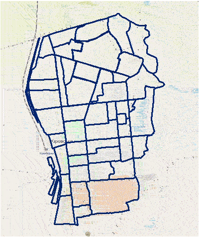
Figure 1 – Construction of buffer zones
(animation: 4 frames, 5 cycles of repetition, 479 kilobytes)
Conclusion
This master’s work solves the practical task of automating the standard monetary valuation of land in populated areas based on the ArcMAP GIS.
At this stage, the master's work is in the process of improving the already developed algorithms to automate the process of regulatory monetary valuation of land. Final completion of work July 2019.
References
- Автореферат магистерской работы [Электронный ресурс]. –Режим доступа: http://masters.donntu.ru/....
- Федун А. Зарубежный опыт правового регулирования денежной оценки земли / А. Федун. – М.: Наука, 2015. – 94 с.[Электронный ресурс]. – Режим доступа: https://ibn.idsi.md/....
- Помощь в учёбе и работе [Электронный ресурс]. – Режим доступа: https://studyes.com.ua/....
- Пылаева А. В. Модели и методы кадастровой оценки недвижимости [Электронный ресурс]. – Режим доступа: http://www.bibl.nngasu.ru/....
- Development of Land Valuation System [Электронный ресурс]. –- Режим доступа: http://fig.net/resources/....
- Борисова А.С. Сравнительный анализ принципов оценки недвижимости в Великобритании и России [Электронный ресурс]. – Режим доступа: https://cyberleninka.ru/....
- Румянцев Д. В.,Хавин Д. В., Бобылев В. В., Ноздрин В. Оценка земли – Нижний Новгород, 2003. – 288с.
- Кошель А. О. Массавая оценка земель: шведский опыт и перспективы использования концептуальных методов в Украине – 121 с.
- «NOTABENE» Особенности земельных отношений в Скандинавских странах [Электронный ресурс]. – Режим доступа: http://e-notabene.ru/....
- Аналитическая справка по системе оценки недвижимости [Электронный ресурс]. – Режим доступа: http://www.pandia.ru/....
- Быкова Е. Н. Опыт оценки земель в Германии [Электронный ресурс]. – Режим доступа: https file:///C:/Users/TEMP.GIG.006/....
- Grundgesetz fur die Bundesrepublik Deutschland [Электронный ресурс]. – Режим доступа: https://www.gesetze-im-internet.de/gg/GG.pdf....